The Press
Before satellites mapped the globe, the printing press gave sailors a shared network for reading the sky
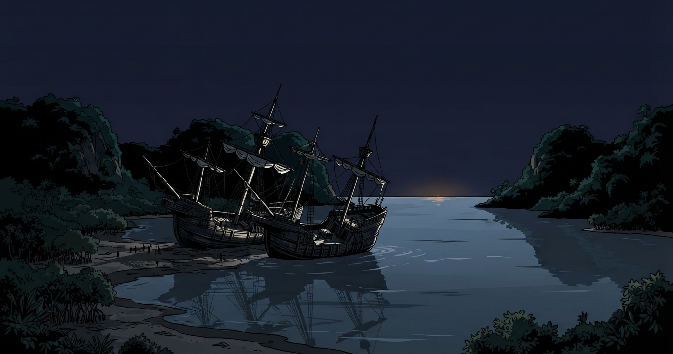
On February 29th 1504, two wooden ships sat run aground in the mud of a Jamaican bay. For months, the men on board had been living on whatever food the local Taíno people brought them. But after a long string of conflicts and bad behaviour from the crew, the food had stopped coming. The ships were out of rations.
Inside a small cabin, Christopher Columbus turned the pages of a printed book. He picked up an hourglass, set it on a bench, and waited.
Outside, the sky kept its end of the bargain. A shadow edged its way across the full moon, crawling across the silver light until the lunar surface darkened to a bruised red.
On the shore, the reaction was immediate. Canoes braved the surf as villagers rushed to the beach with baskets of maize and fish, calling out to the ships. The food was hauled aboard.
The drama of the darkened moon dissolves into something far more interesting: a reference check. Columbus commanded nothing; he looked the answer up. History's version of the night comes filtered through Ferdinand Columbus and a Spanish priest, neither inclined to understate the captain's genius, leaving our knowledge of the Taíno reaction entirely in the dark. The wonder rested on the bench beside the hourglass, on a page calculated by strangers years before, and a captain who knew which one held the future.
That was true of everything Columbus leaned on that night. The calculations, the tables, the timing: none of it was made on the ship, or by him. It began with a special book.
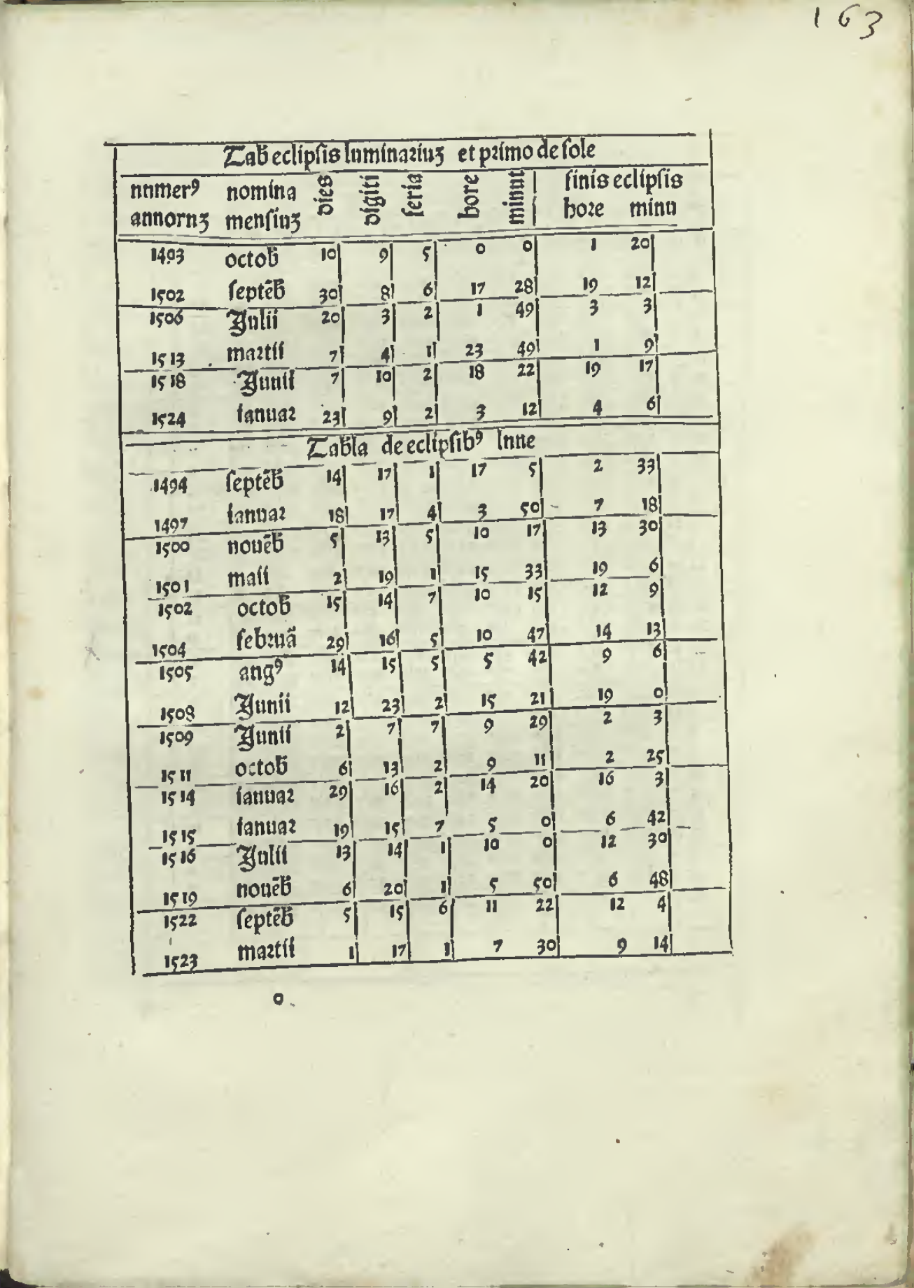
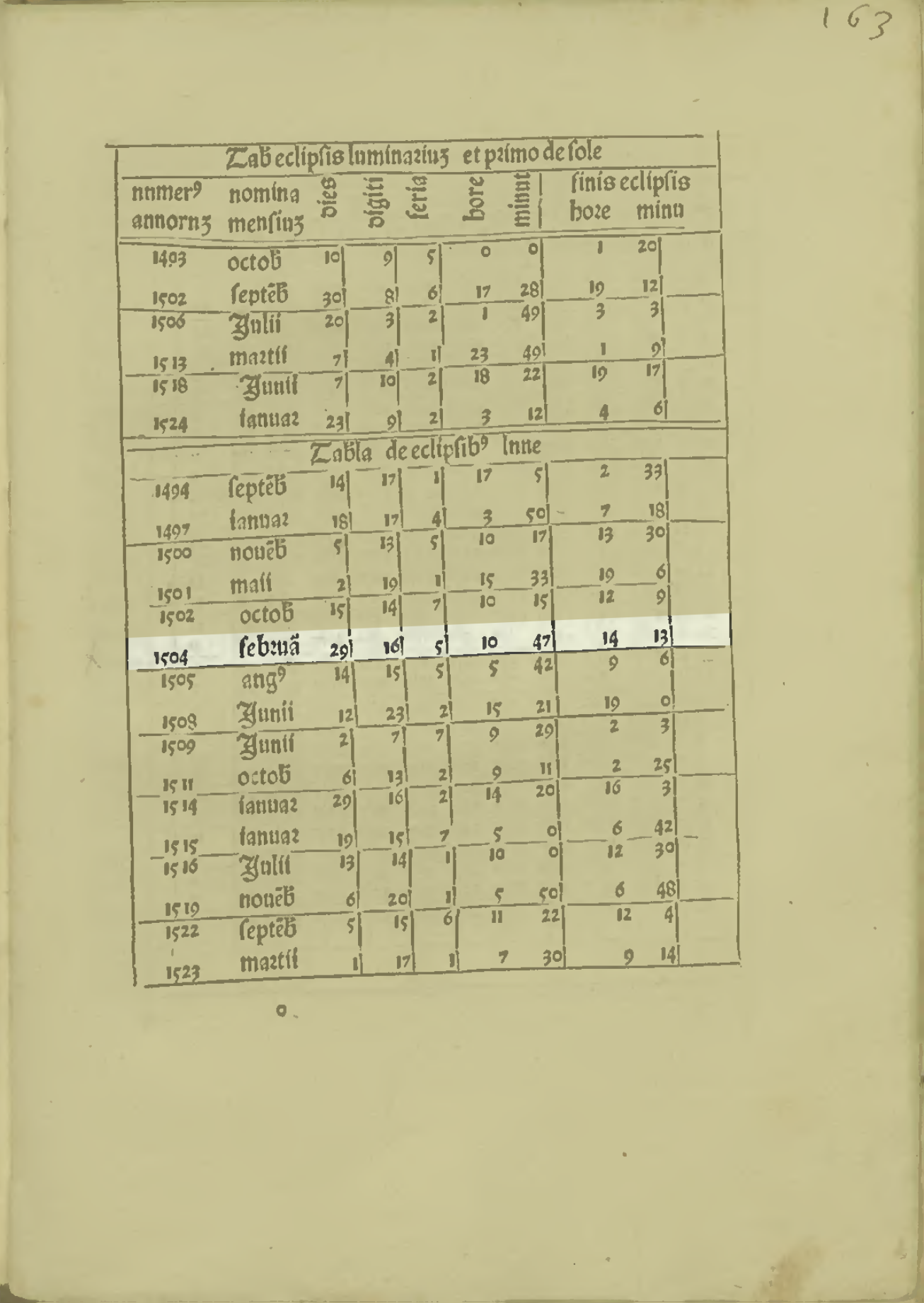
The book in the cabin was Abraham Zacuto’s Almanach Perpetuum, published in the Portuguese town of Leiria in 1496 as one of Europe’s earliest scientific texts. It was packed with figures tracking the sun and stars to help sailors find their position when land disappeared.
Finding your location means knowing two numbers. Imagine the Earth wrapped in a grid of invisible lines: latitude, how far north or south you are, and longitude, how far east or west. Latitude was the one the sky could tell you. Each day the Sun climbs to a slightly different height at noon, and Zacuto's tables listed where it should reach on every date of the year. Measure that height with an astrolabe, find the day in the table, and the gap between the two told you how far north or south you had sailed.
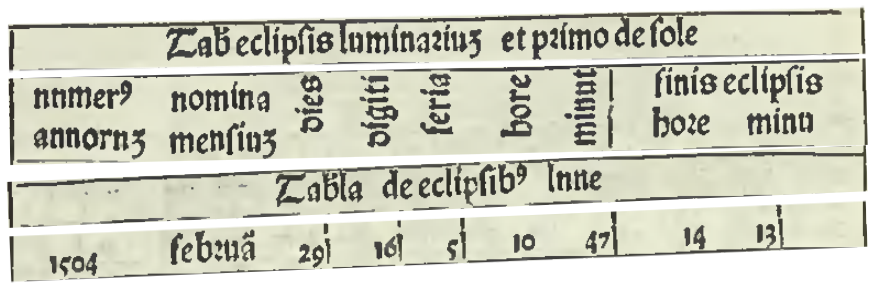
1504 · February 29
Sixteen digits · the Moon full in shadow, a total eclipse
Feria five · a Thursday
Begins 10h 47m · ends 14h 13m
Zacuto built on the work of an astronomer named Regiomontanus. In 1474, in a workshop in Nuremberg, he set up his own press to print his tables titled The Ephemerides. They mapped the position of the sky years in advance. He had done the calculations and made them available so a sailor didn't have to. Yet the system was far from infallible. Columbus carried two different printed tables, and he had already caught them disagreeing with each other.
The dispute pointed to something more concerning. Numbers are dangerous in a way that ordinary words are not. In a hand-copied book, a dropped word is usually obvious. But a misplaced numeral is much more difficult to notice, to all intents and purposes, invisible. If a single digit was smudged when being copied, an 8 could easily appear as a 3. On the page it seems trivial, a simple mistake you'd be hard pushed to catch. At sea, however, it is five degrees of latitude, which could hide a whole island, a coast you encounter in the dark instead of at noon.
We imagine the printing press as a corrector, but its real gift was something unexpected. A press does not know a right number from a wrong one; what it guarantees is that every copy is the same. While that sounds like a great way to spread mistakes, it was also the antidote. When transcribed by hand, every book carried each scribe's own private slips, a unique mess of errors in each copy. Printed, the identical mistake sat in the same row of every book in the fleet.
A thousand identical mistakes can be hunted down and fixed once; a thousand different ones never can.
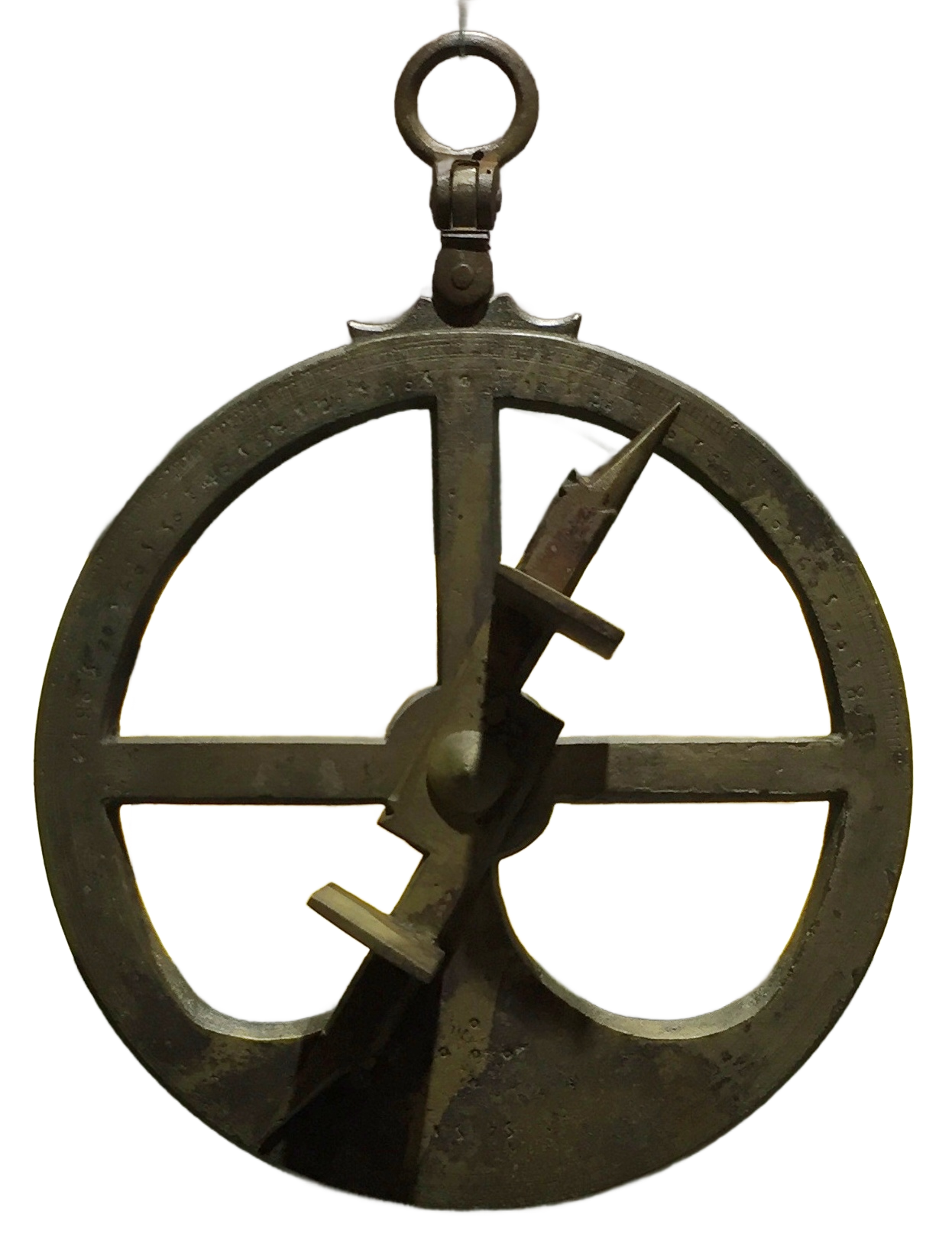
That reliability mattered most at sea. These were the numbers that told a ship where it stood, and a dropped digit there could put it on the rocks. Even so, the table was only half the tool. An astrolabe by itself was just an expensive piece of brass, and a table by itself was just numbers on a page. Neither was any use without the other.
As ships sailed further south along the coast of Africa, the traditional ways of navigating stopped working. The Pole Star sank lower and lower until it disappeared from sight. It had been the north's steady measuring stick, as dependable as the Sun; once it set for good, that tool was simply gone. To navigate south of the equator, sailors had to turn to the Sun. But a midday angle meant nothing without a table to compare it to. Zacuto’s solar tables provided that translation. Carried on Vasco da Gama’s 1497 voyage, they became the foundation of Portuguese pilot manuals. The tables did not replace seamanship, but they did make knowing latitude possible after the familiar northern stars slipped below the horizon.
Even so, latitude was only one of two coordinates. Longitude remained out of reach.
Before accurate mechanical clocks, a lunar eclipse offered the only absolute astronomical method for finding east-west position. An eclipse is a clock the whole hemisphere can read at once: if your table says it happens at a certain hour back home, and you note the hour where you stand, the difference is how far east or west you have come.
This is the other half of that night on the beach. The eclipse that fed Columbus's crew was also his attempt to find where on Earth he stood, and he missed by about two and a half hours, misled by the too-small Earth printed in the 1477 Bologna edition of Ptolemy. This was a mistake still waiting to be hunted down. It would be caught in the end, but not in time for Columbus.
For everyday sailing, longitude was a working estimate. Ships ran on dead reckoning, much like trying to cross your bedroom in the pitch dark by keeping track of your steps and turns from the doorway. Day by day, they estimated their position based purely on how fast they sailed and what direction they steered from the last known spot. The absolute astronomical fix was a rare luxury; the educated guess was what kept the ship afloat.
Knowledge of where you were and what was around the corner had always been valuable, and the powers who held it recognised that. Spain and Portugal tried to treat geography as a state secret. In Seville, the Spanish crown kept a confidential master chart, updated with every newly discovered coast. In practice though, the secrets leaked out through taverns and port pilots anyway. The deeper reason was simpler: you can hide a coastline which exists only as a single guarded copy; you cannot hide a sky because its figures were printed, identical, into every almanac in the fleet.
You cannot classify the Sun's declination.
Standing back, the whole system was a relay of hands:
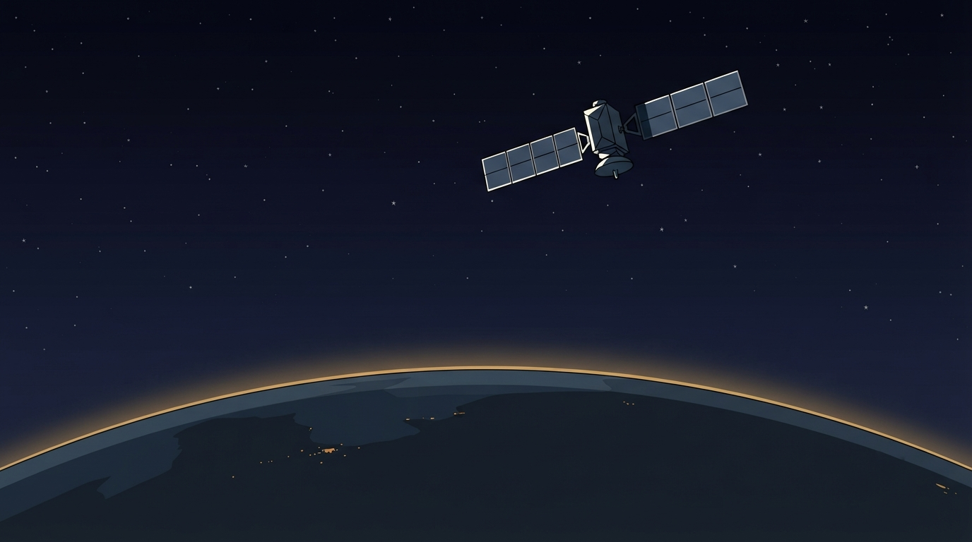
Five centuries later, the modern method follows the same sequence:
The old instinct to hoard knowledge was never far away though. Where Spain had locked its master chart in a vault, the United States kept its most accurate GPS signal for itself, and handed everyone else a version deliberately made a little fuzzy. It didn't last. Others found ways to correct much of the blur, until keeping it secret protected nobody, and on 1 May 2000 the distortion was switched off. Overnight, civilian navigation became about ten times sharper. We built this version of the sky ourselves, so unlike the old one, we can still hide some of it.
When we examine the navigation message streaming down from 20,000km, the ancient term is still right there: satellites broadcast ephemerides, the precise, constantly updated timetable of where each satellite will be in the sky. The word comes from the Greek for lasting a day. Astronomers borrowed it centuries ago for tables that expired with the calendar; it's a strange quirk that our seemingly most permanent architecture carries such a perishable name. And the physics bear it out: the broadcast ephemeris is valid for only hours, and without fresh ground uploads, the network's accuracy decays over the following two weeks.
The machinery endures, anchored to a name that recalls how quickly things expire.
Named for a day, the table outlived every empire it crossed. The Spanish crown expelled Abraham Zacuto in 1492 and then Columbus, sailing for that very crown, used Zacuto's almanac to save his stranded crew on a Jamaican beach. The empire that banished him steered by his tables regardless.
From a man hunched over a printed book in a dark cabin to you, watching a glowing blue dot pinpoint your location on a map. The tools have changed, but the work is the same: someone else does the heavy lifting of the calculation, and you simply inherit the result.